This document describes how to use UMN MapServer with Ordnance Survey data.
MapServer will probably have some performance issues if you're using it in an AJAX environment, but it's worth trying first.
These instructions describe the process on Microsoft Windows, however it should be easy to apply them on a unix platform.
Download MapServer
http://mapserver.org/download
Unzip to
C:\MS4W\
You can change the drive *letter* only
To avoid conflicts with things like Microsoft IIS, I would suggest changing the port it listens on from 80 to 81 eg....
"C:\ms4w\Apache\conf\httpd.conf"
Change listen port from 80 to 81.
Go to C:\ms4w\apache\bin and run httpd.exe
The tutorial is good...
http://biometry.gis.umn.edu/tutorial/
I'd only worry about the first section for WFS/WMS funcitonality.
After you've installed that, this URL should work...
http://localhost:81/tutorial/example1-1.html
This should display a map using this URL...
http://localhost:81/cgi-bin/mapserv.exe?map=/ms4w/apps/tutorial/htdocs/example1-1.map&layer=states&layer=states_line&mode=map
A working example
of the tutorial project should be hosted here so you can see what you should be getting...
http://biometry.gis.umn.edu/tutorial/example1-1.html
Getting the mapserver installed tools to work sensibly for data that's not on the same disk.
Copy...
C:\ms4w\setenv.bat
To...
C:\ms4w\setenv2.bat
Edit setenv2.bat and replace all paths that start with "\" with "c:\"
eg.
set PATH=\ms4w\Apache\cgi-bin;\ms4w\tools\gdal-ogr; ...
becomes...
set PATH=C:\ms4w\Apache\cgi-bin;C:\ms4w\tools\gdal-ogr; ...
TODO: Find out what %[Something] will get replaced with "C:\MS4W\" (on Win2K+)
Run setenv2 and you should be able to run:
Note: You can have one root data directory per MapServer map called the "SHAPEPATH". We're going to use "C:\GIS1\Maps\" and try to work with relative paths from there.
Sensible folders for maps might be...
C:\GIS1\Maps\250K\
C:\GIS1\Maps\50K\
C:\GIS1\Maps\StreetView\
Download the appropriate georeference files from the Ordnance Survey...- use TFW format...
http://www.ordnancesurvey.co.uk/oswebsite/products/georeferencing/aboutpopup.html
Unzip the files into the same directory as the images.
We can use gdalinfo to get information about an image which should include placement from the TFW eg...
gdalinfo TQ.tif | more
C:\GIS1\Temp>dir Volume in drive C has no label. Volume Serial Number is AC53-4476 Directory of C:\GIS1\Temp 11/03/2007 08:08 <DIR> . 11/03/2007 08:08 <DIR> .. 11/03/2007 08:11 189 tq.map 21/04/2001 14:59 3,615,355 TQ.png 25/02/2004 18:12 127 TQ.TFW 3 File(s) 3,615,671 bytes 2 Dir(s) 125,042,814,976 bytes free C:\GIS1\Temp>gdalinfo TQ.png | more Driver: PNG/Portable Network Graphics Size is 4000, 4000 Coordinate System is `' Origin = (500000.000000000000000,200000.000000000000000) Pixel Size = (25.000000000000000,-25.000000000000000) Corner Coordinates: Upper Left ( 500000.000, 200000.000) Lower Left ( 500000.000, 100000.000) Upper Right ( 600000.000, 200000.000) Lower Right ( 600000.000, 100000.000) Center ( 550000.000, 150000.000) Band 1 Block=4000x1 Type=Byte, ColorInterp=Palette Color Table (RGB with 256 entries) 0: 255,255,255,255 1: 59,43,47,255 2: 62,42,67,255 3: 61,41,90,255 -- More --
You can see we have "Corner Coordinates" from the TFW that are in OS grid references. We also have no cordinate system declared - that's probably OK for now - OS grid references get complicated. If you don't have a good TFW file, you'll probably have an upper left coordinate of 0 0 and it'll be placed in pixel coordinates, which you'll need to fix before you proceed.
The Map file required to render that image in MapServer would be as follows:
#Map file in C:\GIS1\Temp\tq.map MAP EXTENT 500000 100000 600000 200000 SIZE 400 300 LAYER TYPE RASTER DATA "C:\GIS1\Temp\TQ.png" STATUS DEFAULT END END
We can request this with the following URL:
http://localhost:81/cgi-bin/mapserv.exe?mode=map&map=/GIS1/temp/tq.map
The Ordnance Survey send out images in a number of formats which may or may not be optimal for processing. You will probably want to convert them anyway, just to make sure everything is consistant.
Copy your source maps and TFW files into a temporary directory and then run gdal_translate to translate them into an appropriate location:
C:\GIS1\Temp\250K>gdal_translate -co COMPRESS=LZW -co tiled=yes -co TFW=yes TQ.PNG C:\GIS1\Data\250K\TQ.TIF Input file size is 4000, 4000 0...10...20...30...40...50...60...70...80...90...100 - done. C:\GIS1\Temp\250K>
The above command will translate the files back into C:\GIS1\Data\250K\. The files will be internally tiled TIF images that may not render properly in very many imaging programs. Irfanview (http://www.irfanview.com/) will be able to display and convert a large range of image formats. files
MapServer will probably have some performance issues if you're using it in an AJAX environment, but it's worth trying first.
TODO: See if there are any more optimal compression options - not many people use 8 bits per pixel images.
To import a load of maps, you can use a 'for' loop like this...
C:\GIS1\Temp\250K>for %f in (*.png) do gdal_translate -co COMPRESS=LZW -co tiled=yes -co TFW=yes %~nf.PNG C:\GIS1\Data\250K\%~nf.TIF C:\GIS1\Temp\250K>gdal_translate -co COMPRESS=LZW -co tiled=yes -co TFW=yes TM.PNG C:\GIS1\Data\250K\TM.TIF Input file size is 4000, 4000 0...10...20...30...40...50...60...70...80...90...100 - done. C:\GIS1\Temp\250K>gdal_translate -co COMPRESS=LZW -co tiled=yes -co TFW=yes TQ.PNG C:\GIS1\Data\250K\TQ.TIF Input file size is 4000, 4000 0...10...20...30...40...50...60...70...80...90...100 - done. C:\GIS1\Temp\250K>gdal_translate -co COMPRESS=LZW -co tiled=yes -co TFW=yes TR.PNG C:\GIS1\Data\250K\TR.TIF Input file size is 4000, 4000 0...10...20...30...40...50...60...70...80...90...100 - done. C:\GIS1\Temp\250K>gdal_translate -co COMPRESS=LZW -co tiled=yes -co TFW=yes TV.PNG C:\GIS1\Data\250K\TV.TIF Input file size is 4000, 4000 0...10...20...30...40...50...60...70...80...90...100 - done. C:\GIS1\Temp\250K>
We now have our optimally stored TIFF files in C:\GIS1\Data\250K\
We need to build an index of them so they can be quickly located and indexed. We do this with the 'gdaltindex' command which generates a shape file index. The shape file contains rectangles that define where the images are and have an attribute that indicates where the tile is.
Because of the way the mapserver resolves relative paths, you always want to run 'gdaltindex' in the directory that your the root of your data directory (or wherever your 'SHAPEPATH' points).
C:\GIS1\Data>gdaltindex 250KIndex 250k\*.TIF Creating new index file... C:\GIS1\Data>dir Volume in drive C has no label. Volume Serial Number is AC53-4476 Directory of C:\GIS1\Data 11/03/2007 08:30 <DIR> . 11/03/2007 08:30 <DIR> .. 11/03/2007 08:23 <DIR> 250K 11/03/2007 08:30 1,089 250KIndex.dbf 11/03/2007 08:30 644 250KIndex.shp 11/03/2007 08:30 132 250KIndex.shx 3 File(s) 1,865 bytes 3 Dir(s) 125,029,220,352 bytes free C:\GIS1\Data>
The paths in the index are as you put them on the 'gdaltindex' commandline eg. "250K\TQ.TIF" in this case. MapServer will append that path onto the SHAPEPATH.
We can now build a MapServer map from those tiles as follows:
#Map file in C:\GIS1\Temp\250k.map MAP EXTENT 500000 100000 700000 200000 SIZE 400 300 SHAPEPATH "C:\GIS1\Data\" LAYER TYPE RASTER STATUS DEFAULT TILEINDEX "250KIndex.shp" END END
You should be able to request that from the following URL:
http://localhost:81/cgi-bin/mapserv.exe?mode=map&map=/GIS1/temp/250k.map
GDAL will import NTF and GML data, however support is somewhat limited and there is no easy way to infer Ordnance Survey's default styling.
To import MasterMap topographical data we'd recommend you use Edonica's MasterMap importer. This is open source but only free for development, testing, demonstrations and non commercial use.
An example MapServer configuration for rendering the Ordnance Survey data is below:
Note that symbols and styles are not supported. Refer to the readme.txt file included for more instructions.
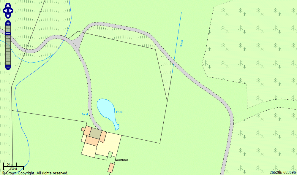
Below is an example image generated with this configuration and some Ordnance Survey sample data.
Donald Kerr has provided us with a new MapServer template which is available for download here:
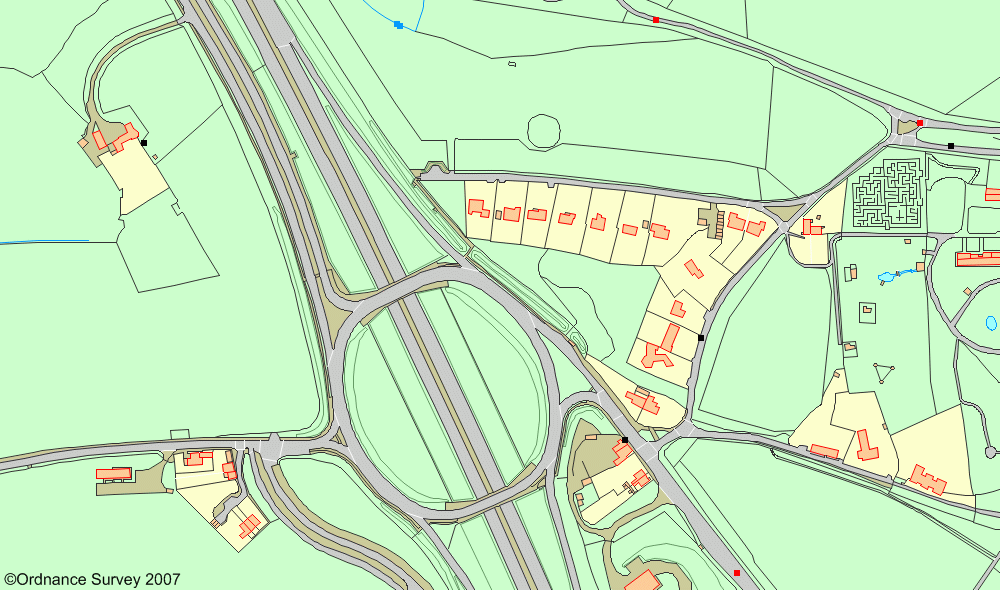
This has OS symbols provided via a TrueType font and a number of other improvements as you can see from the image below.
More examples: 01_250K.gif 02_250K.gif 03_250K.gif 04_50K.gif 05_50K.gif 06_50K.gif 07_10K.gif 08_10K.gif 09_10K.gif 10a_MasterMap.gif 10b_MasterMap.gif 10c_MasterMap.gif 11_MasterMap.gif 12_MasterMap.gif
OpenLayers have a great AJAX based mapping client that will talk to MapServer, along with lots of documentation. You may be able to get round some performace problems with TileCache and FastCGI
We've done some research into Geoserver, a Java based rendering engine which may provide better performance, however installation / configuration is quite painful. It might be the case that the detail level in Ordnance Survey maps is more than most US based GIS systems can cope with.